
Spanish road signs follow the European system, so many will look familiar, but the details matter in the DGT theory test: several questions in every exam show a sign and ask what it means or what you must do. Each sign below has its official code (for example P-1 or R-2), its name in English and a short explanation.
The quickest way to read a sign you do not know is its shape and colour:
| Shape and colour | Type | What it tells you |
|---|---|---|
| Triangle with a red border | Warning (P-) | A danger ahead: slow down and be ready. |
| Circle with a red border | Prohibition (R-) | Something you must not do. |
| Blue circle | Mandatory (R-4xx) | Something you must do. |
| Octagon, inverted triangle, yellow diamond | Priority (R-1 to R-6) | Stop, give way, or who has priority. |
| Blue or white rectangle | Information (S-) | Information about the road and the area. |
Warning signs
Red-bordered triangles. They warn you of a danger ahead, so you can slow down and take care. On conventional roads they are usually placed 150-250 metres before the danger.
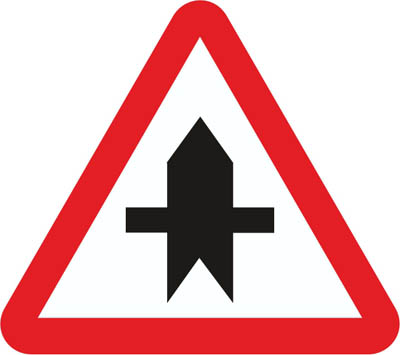
Danger due to the proximity of an intersection with a road, whose users must give way.
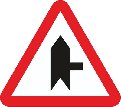
Danger due to the proximity of an intersection with a road to the right, whose users must give way.
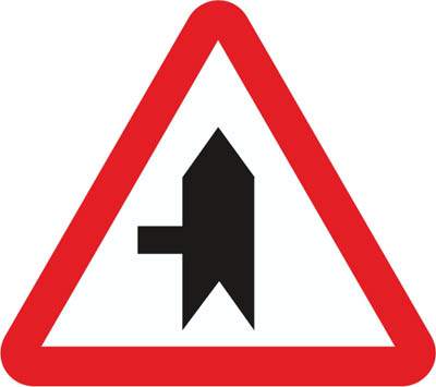
Danger due to the proximity of an intersection with a road to the left, whose users must give way.
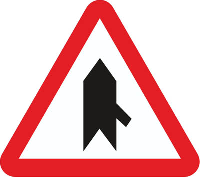
Danger due to the proximity of a merging from the right, whose users must give way.
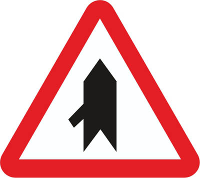
Danger due to the proximity of a merging from the left of a road, whose users must give way.
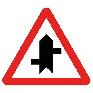
Danger due to the proximity of a section where there are several direct accesses to the road, and users of these direct accesses must give way.
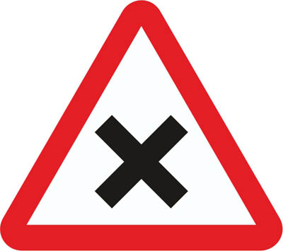
Danger due to the proximity of an intersection where the general rule of priority applies.
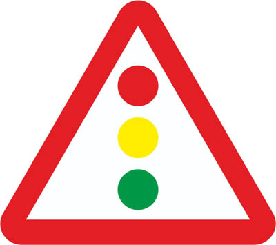
Danger due to the proximity of an isolated intersection or sections regulated by traffic lights.
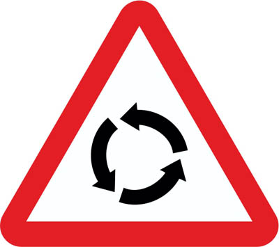
Danger due to the proximity of an intersection where traffic circulates in a rotary manner in the direction of the arrows.
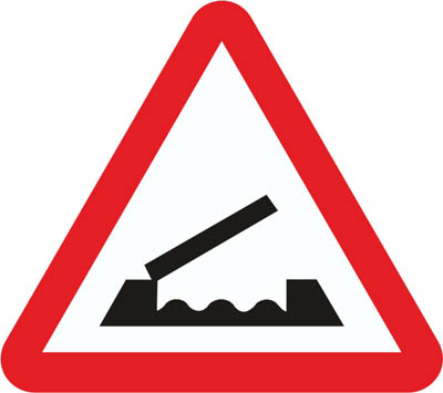
Danger due to the proximity of a bridge that can be raised or swung, thus temporarily interrupting traffic.
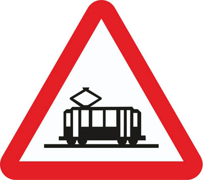
Danger due to the proximity of a crossing with a tram line, which has priority.
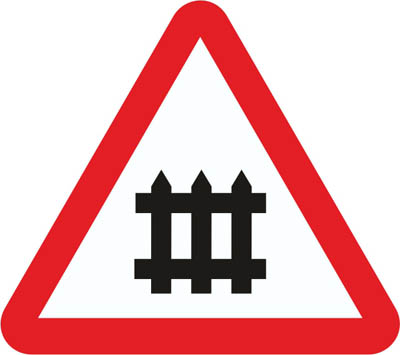
Danger due to the proximity of a level crossing equipped with barriers or half-barriers.
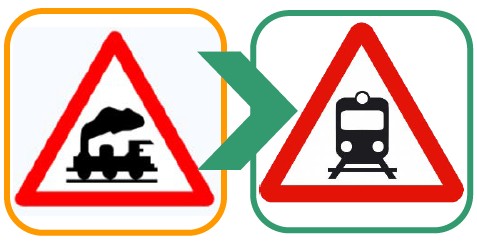
Danger due to the proximity of a level crossing not equipped with barriers or half-barriers.
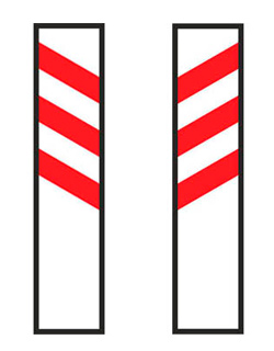
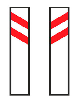
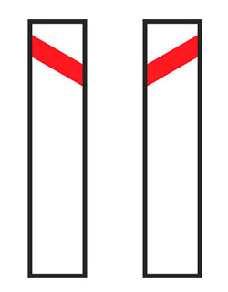
This beacon is always accompanied by one of these signs P-5, P-7, P-8 or P-27.


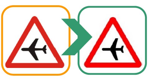
Danger due to the proximity of a location where aircraft frequently fly at low altitude over the road, which may cause unexpected noise.
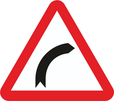
Danger due to the proximity of a curve to the right.
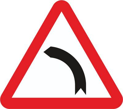
Danger due to the proximity of a curve to the left.
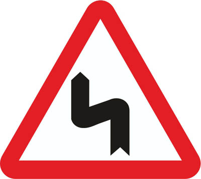
Danger due to the proximity of a series of closely spaced curves; the first to the left.
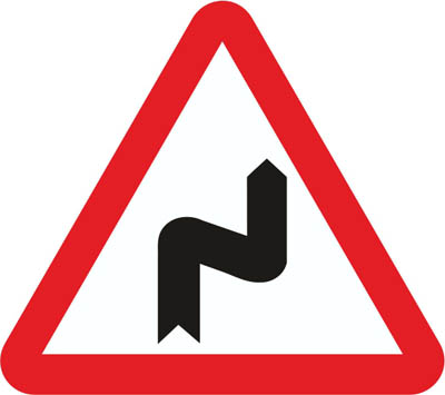
Danger due to the proximity of a series of closely spaced curves; the first to the right.
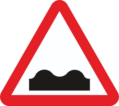
Danger due to the proximity of a hump or dip in the road or pavement in poor condition.
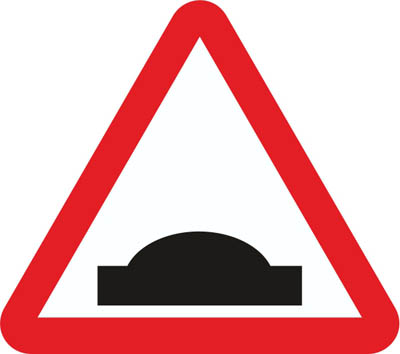
Danger due to the proximity of a hump in the road.
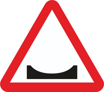
Danger due to the proximity of a dip in the road.
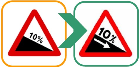
Danger due to the proximity of a section with a steep downhill slope.
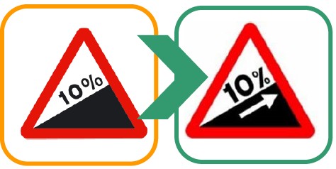
Danger due to the proximity of a section with a steep uphill slope.
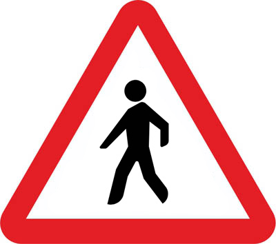
Danger due to the proximity of an area or section with a high volume of pedestrian traffic.
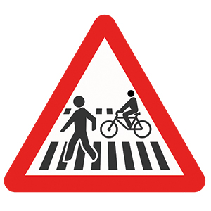
Danger due to the proximity of a pedestrian crossing attached to or shared with a cycle crossing.
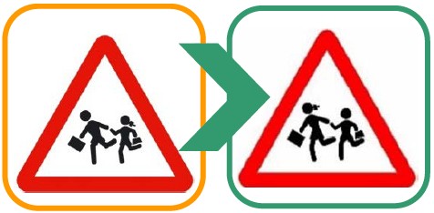
Danger due to the proximity of a place frequented by children, such as schools, playgrounds, etc.
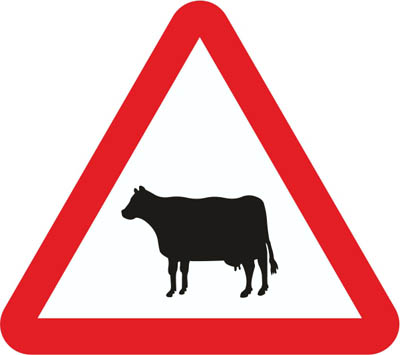
Danger due to the proximity of a place where the road may frequently be crossed by domestic animals.
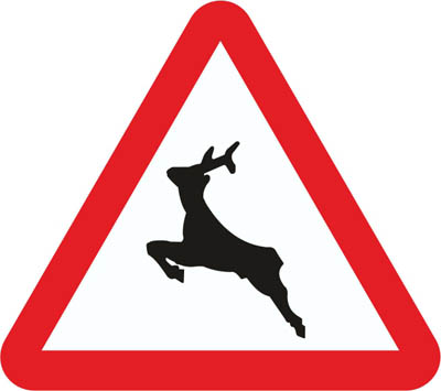
Danger due to the proximity of a place where the road may frequently be crossed by wild animals.
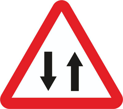
Simply warns us that the road is two-way, so there are cars going up and cars going down.
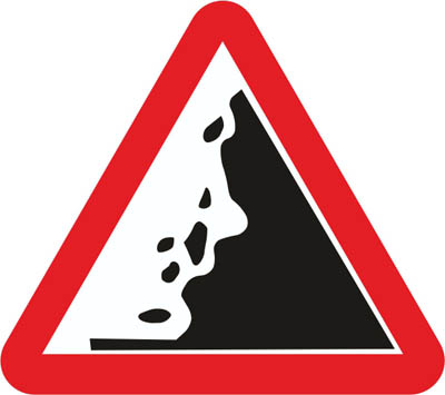
Danger due to the proximity of an area with frequent landslides and the consequent possible presence of obstacles on the road.
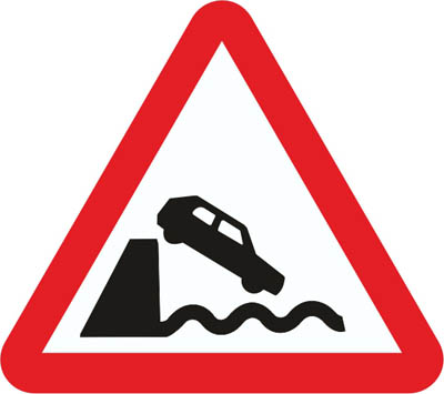
Danger due to the road leading to a wharf or a body of water.
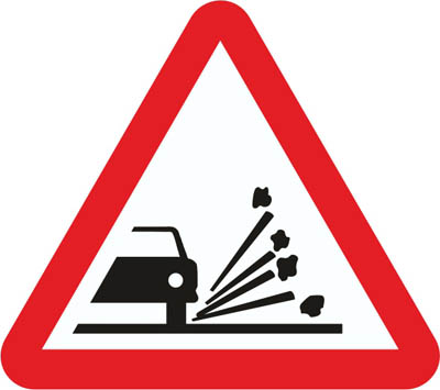
Danger due to the proximity of a section of road where there is a risk of vehicles throwing or projecting gravel or sand when passing.
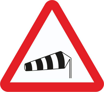
Danger due to the proximity of an area where wind frequently blows in a cross direction.
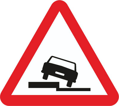
Danger due to the presence of a drop along the road, on the side indicated by the symbol.
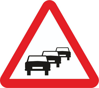
Danger due to the proximity of a section where traffic is halted or hindered by congestion.
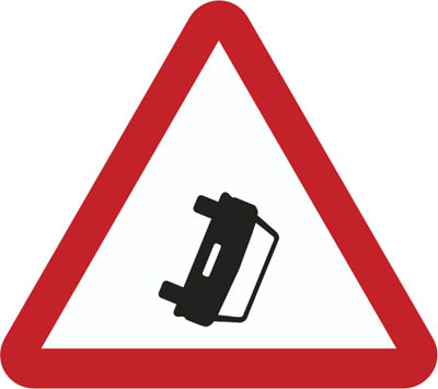
Danger due to the proximity of a place where vehicles obstruct the roadway due to a breakdown, an accident, or other causes.
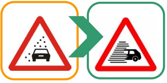
Danger due to the proximity of a section where traffic is hindered by a significant loss of visibility caused by fog, rain, snow, or smoke.
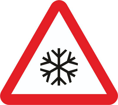
Danger due to the proximity of an area of the roadway where the surface may be very slippery due to ice or snow.

Indicates the proximity of a danger different from those warned by other signs.
Priority signs
They tell you who goes first at junctions and narrow sections: give way, stop, priority road and priority over oncoming traffic.
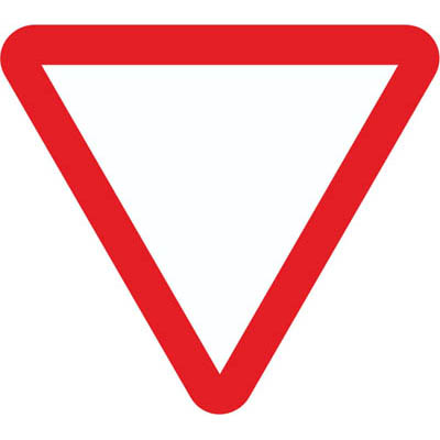
Requires giving way at the next intersection to vehicles travelling on the road you are approaching or the lane you intend to join.
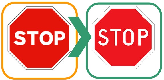
Requires stopping your vehicle at the next stop line or, if none exists, immediately before the intersection, and giving way there to vehicles travelling on the road you are approaching.
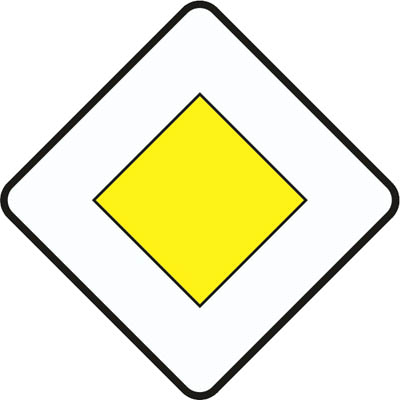
Indicates to drivers of vehicles travelling on a road their priority at intersections over vehicles travelling on another road.
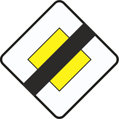
Indicates the proximity of the place where the road you are travelling on loses its priority over another road.
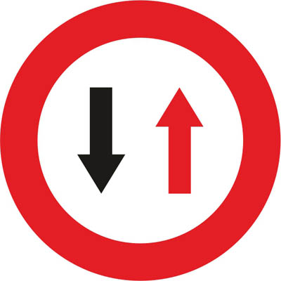
Prohibits entry into a narrow passage unless it is possible to pass through without forcing vehicles travelling in the opposite direction to stop.
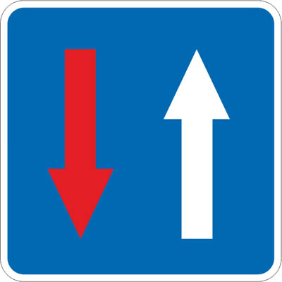
Indicates to drivers that, at an upcoming narrow passage, they have priority over vehicles travelling in the opposite direction.
No entry signs
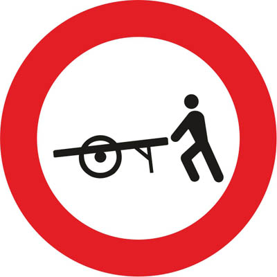
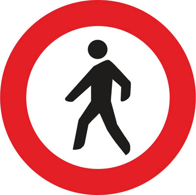
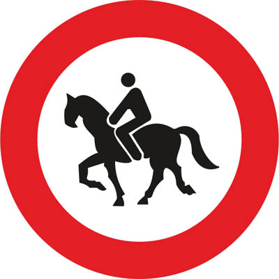
Red circles that forbid entry to all vehicles or to specific types of vehicle or road user.

Prohibition of circulation of all types of vehicles in both directions.
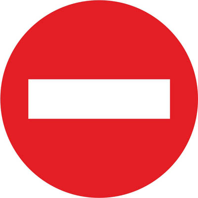
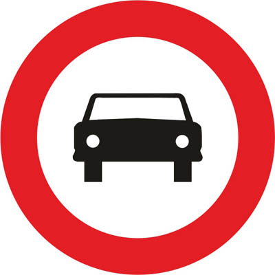
Prohibition of access to all types of vehicles.
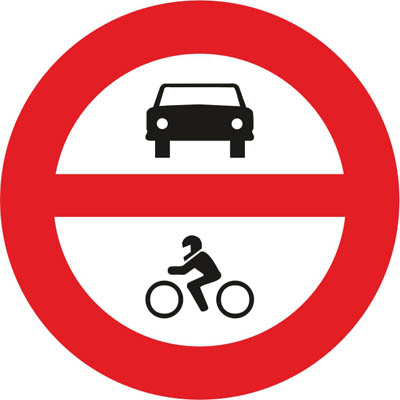
Prohibition of access to all types of motor vehicles.
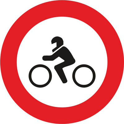
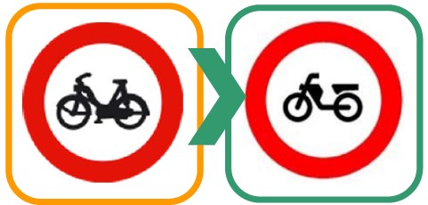
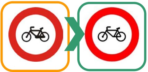
Prohibition of access to mopeds with two and three wheels and light quadricycles. It also prohibits entry to vehicles for persons with reduced mobility.
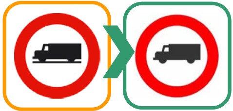
Prohibits access to vehicles intended for the transport of goods, understood as lorries and vans regardless of their MAM (Maximum Authorised Mass).
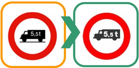
Prohibits access to all types of vehicles intended for the transport of goods if their MAM (Maximum Authorised Mass) exceeds that indicated on the sign, understood as lorries and vans. Entry is prohibited even if they are travelling without a load.
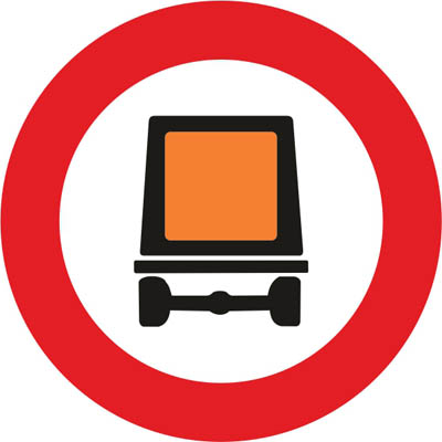
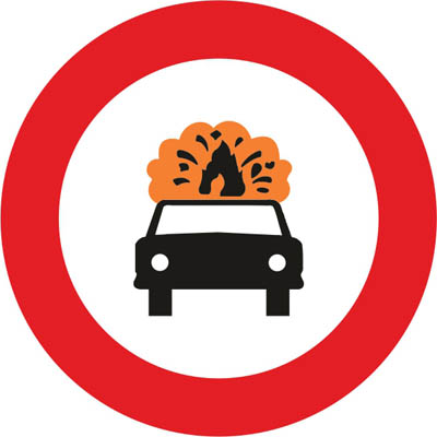
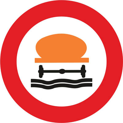
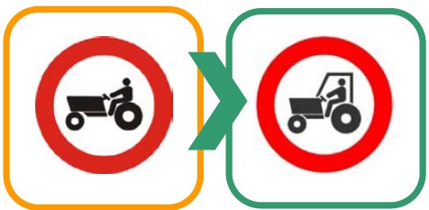
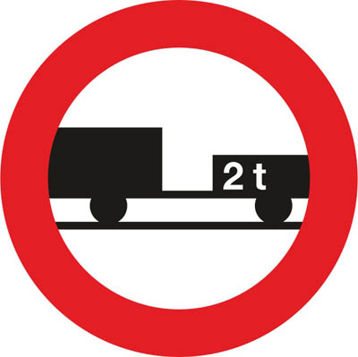
The inscription of a tonnage figure, either on the silhouette of the trailer or on a supplementary plate, means that the prohibition of passage only applies when the Maximum Authorised Mass (MAM) of the trailer exceeds that figure.
Weight, size and stop-control signs
Red circles that limit the weight, length, width or height of vehicles, or tell you where you must stop (customs, police, tolls).
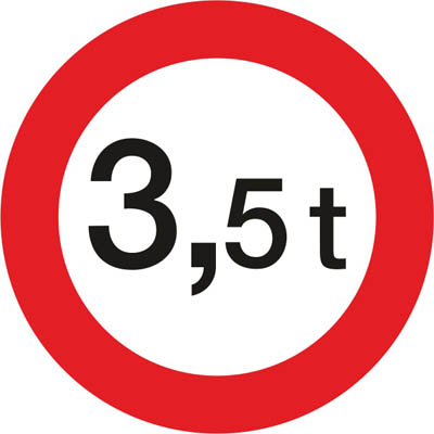
Prohibition of passage for vehicles whose loaded mass exceeds the indicated amount in tonnes.
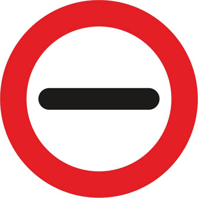
Indicates the place where stopping is mandatory due to the proximity, as indicated by the inscription, of a customs post, police, toll, or other, and where mechanical stopping devices may be installed beyond them (you may not resume driving until you have complied with the requirement established by the sign).
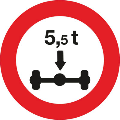
Prohibition of passage for vehicles whose axle load transmitted by all wheels attached to any axle exceeds the limit indicated on the sign. If any of the vehicle's axles bears more weight than the figure indicated, entry is prohibited beyond the sign.
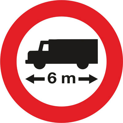
Prohibition of passage for vehicles or combinations of vehicles whose maximum length, including the load, exceeds the limit indicated.
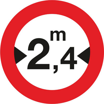
Prohibition of passage for vehicles whose maximum width, including the load, exceeds the limit indicated.
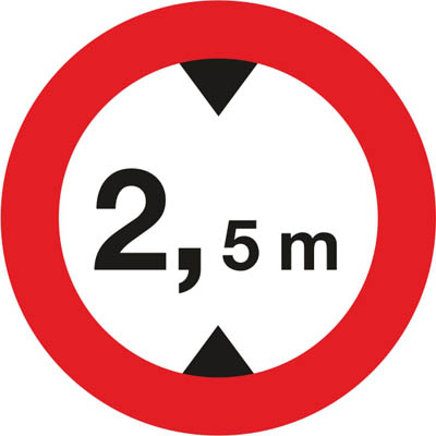
Prohibits passage to vehicles whose maximum height, including the load, exceeds the limit indicated.
Prohibition signs
Red circles that forbid a manoeuvre: turning, U-turns, overtaking, exceeding a speed, stopping or parking.
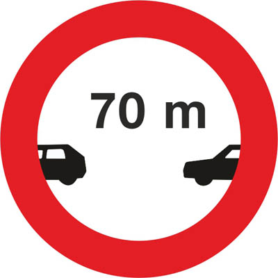
Prohibition of driving without maintaining a distance equal to or greater than that indicated on the sign from the vehicle in front, except when overtaking.
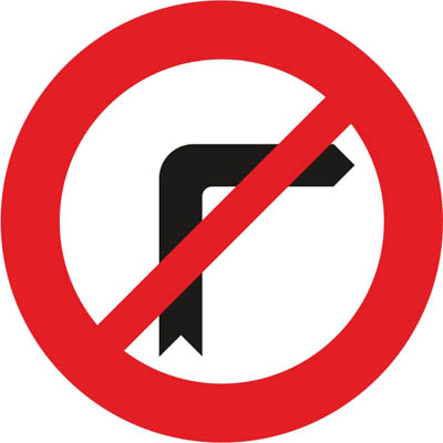
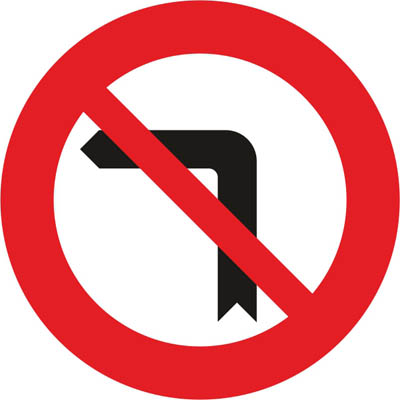
Also prohibits U-turns.
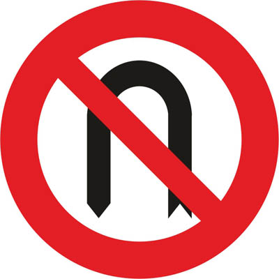
Does not prohibit left turns.
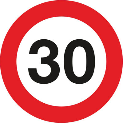
Prohibits driving at a speed exceeding the limit in km/h indicated on the sign. This is mandatory from the location of the sign until the next sign (end of speed limit), (end of prohibitions) or another (maximum speed), unless it is placed on the same post or panel as a warning sign of danger, in which case the prohibition ends when the indicated danger ceases.
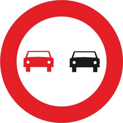
Indicates the prohibition for all vehicles to overtake motor vehicles travelling on the carriageway, unless they are two-wheeled motorcycles and provided that the area reserved for the opposite direction is not invaded, from the place where the sign is located until the next sign of (end of overtaking prohibition) or (end of prohibitions). Placed in locations where overtaking is normally prohibited, it generally reminds us of the prohibition to perform this manoeuvre.
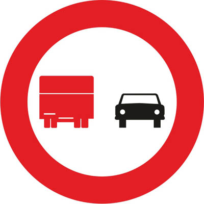
Prohibits lorries whose maximum authorised mass exceeds 3500 kg from overtaking motor vehicles travelling on the carriageway, unless that these are two-wheeled motorcycles and provided that the area reserved for the opposite direction is not encroached upon, from the place where the sign is located until the next sign indicating (end of overtaking prohibition) or (end of prohibitions).
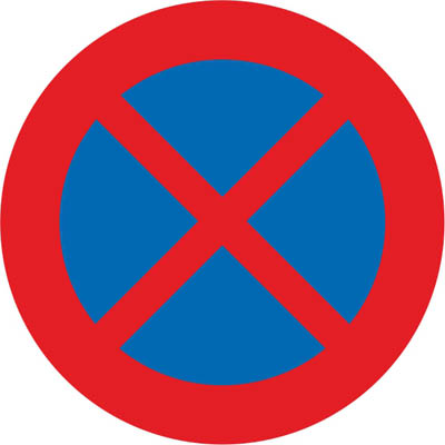
Prohibits stopping and parking on the side of the carriageway where the sign is located. Unless otherwise indicated, the prohibition ends at the nearest intersection.
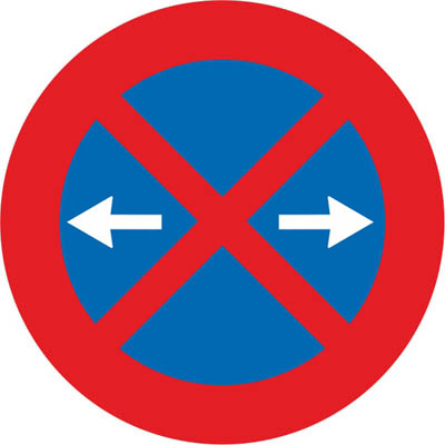
Prohibition of stopping and parking on the side of the carriageway where the sign is located, in the section between the intersections or the nearest R‐307b and R‐307c signs on both sides of the sign.
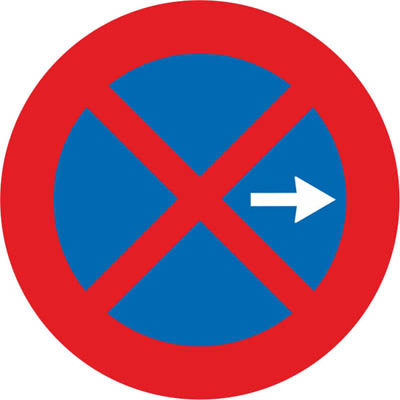
Prohibition of stopping and parking on the side of the carriageway where the sign is located, in the section between the sign and the nearest intersection or R‐307c sign in the direction indicated by the arrow.
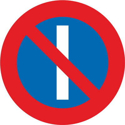
24 hours a day.
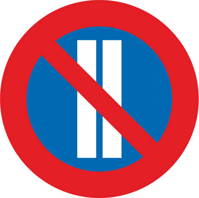
24 hours a day.
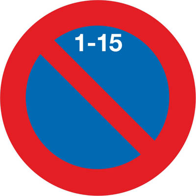
From 9 a.m. on the 1st until 9 a.m. on the 16th.
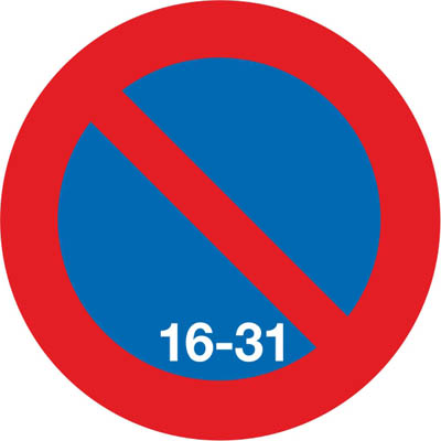
From 9 a.m. on the 16th until 9 a.m. on the 1st.
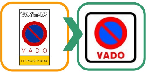
Prohibits parking in front of a driveway.
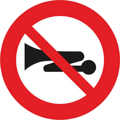
Reminds of the general prohibition on making acoustic signals, except to avoid an accident.
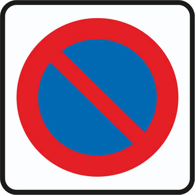
Zone of limited parking duration with the obligation to indicate, in a regulatory manner, the start time of parking, the validity period of the authorisation, and whether parking is subject to payment.
Mandatory signs
Blue circles that tell you what you must do: the direction to follow, a minimum speed, snow chains or the lane reserved for certain users.
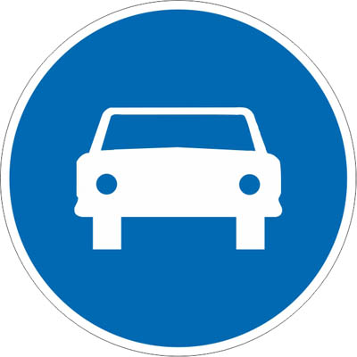
Obliges drivers of automobiles, except motorcycles, to travel on the road at whose entrance it is located.
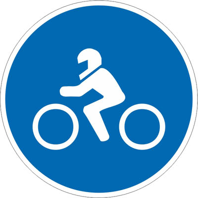
Requires motorcyclists to travel on the road at whose entrance it is located.
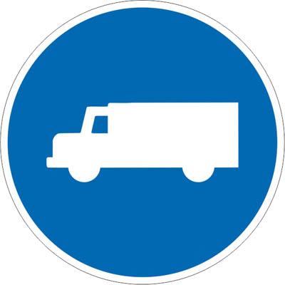
Requires drivers of all types of lorries and vans, regardless of their mass, to travel on the road at whose entrance it is located. The inscription of a tonnage figure on the silhouette of the vehicle or on another supplementary plate means that the requirement only applies when the maximum authorised mass of the vehicle or the combination of vehicles exceeds the stated figure.
Moped drivers are required to use the lane at whose entrance it is located, and other road users are prohibited from using it.
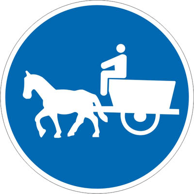
Requires drivers of animal-drawn vehicles to use the path at whose entrance it is located.
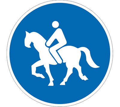
Requires riders to use the path at whose entrance it is located with their mounted animals, and prohibits its use by other users.
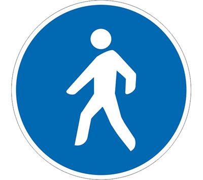
Requires pedestrians to use the path at whose entrance it is located, and prohibits its use by other users.
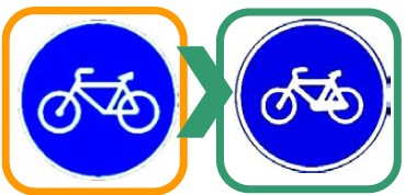
Requires cyclists to travel on the lane at whose entrance it is located and prohibits its use by other users.
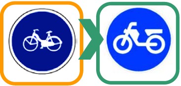
Requires moped riders to travel on the lane at whose entrance it is located and prohibits its use by other users.
End of restriction signs
White circles crossed with grey or black lines: a previous prohibition or limit no longer applies.
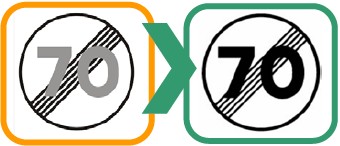
Indicates the place from which a previous maximum speed sign ceases to apply.
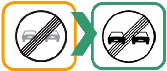
Indicates the place from which a previous no overtaking sign ceases to apply.
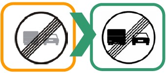
Indicates the place from which a previous no overtaking sign for lorries ceases to apply.
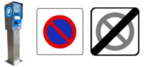
Indicates the point from which a previous sign of a limited parking zone ceases to apply. Beyond the sign, it is no longer a paid parking zone (blue zone).
Information signs
Mostly blue or white rectangles. They give you information about the road you are on: motorways, one-way streets, tunnels, pedestrian zones and more.
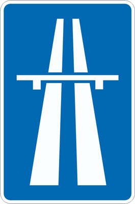
Indicates the beginning of a motorway and, therefore, the point from which the special traffic rules for this type of road apply. It may also indicate the branch of a junction leading to a motorway.
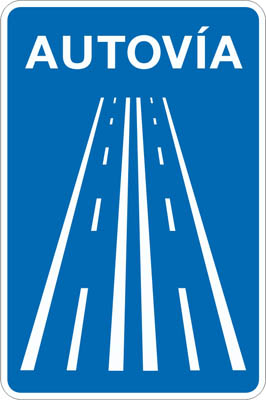
Indicates the beginning of a dual carriageway and, therefore, the point from which the special traffic rules for this type of road apply. It may also indicate the branch of a junction leading to a dual carriageway.
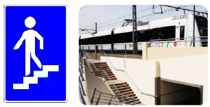
Indicates the location of a pedestrian overpass.
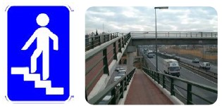
Indicates the location of a pedestrian underpass.
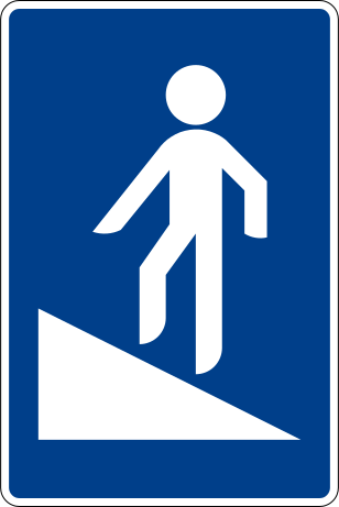
Indicates the location of a pedestrian overpass equipped with a ramp.
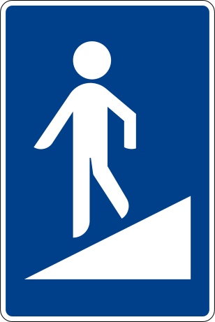
Indicates the location of a pedestrian underpass equipped with a ramp.
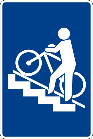
Indicates the location of a pedestrian overpass equipped with a rail or ramp for cycles.
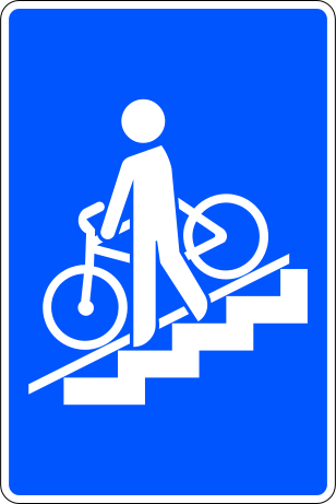
Indicates the location of a pedestrian underpass equipped with a rail or ramp for cycles.
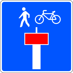
Indicates that the road shown on the sign with a red border has no exit except for pedestrians or cycles.
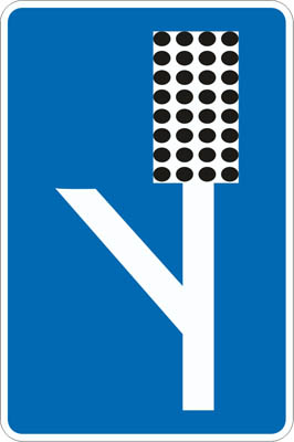
Indicates the location of an escape area from the road, equipped so that a vehicle can be stopped in the event of brake failure.
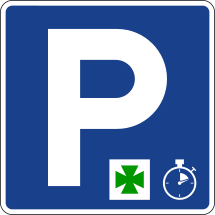
Indicates the location where vehicle parking is authorised solely for a specific purpose (access to a pharmacy, hospital, etc.) whose pictogram will be included on the sign, and for a specified time. The duration of this time will be indicated on a supplementary panel.
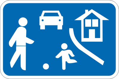
Indicates traffic areas primarily intended for pedestrians, where the following special traffic rules apply: the maximum vehicle speed is set at 10 kilometres per hour, and drivers must give priority to pedestrians; vehicles may only park in places designated by signs or markings; bicycles may travel in both directions unless the competent authority decides otherwise; pedestrians may use the entire traffic area, and therefore pedestrian crossings are not marked; games and sports are permitted. It will always be accompanied by sign R-301, which limits the speed to 10 km/h.
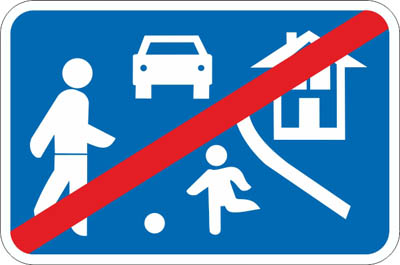
Indicates that general traffic rules apply again.
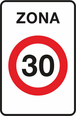
Traffic area adapted and primarily intended for pedestrians, where they have priority. The maximum speed is set at 30 km/h.
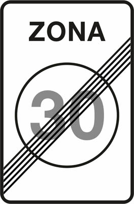
Indicates that general traffic rules apply again.
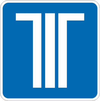
Indicates that you can pay the toll using the dynamic toll or electronic toll system, provided you have the technical means to use it. This sign will be found at a toll, and it gives us the option to pay the toll with cash, credit card, or the telepass device.
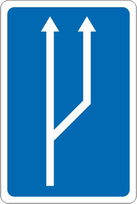
Indicates, on a section with a single lane, that it will transition to two lanes in the same direction of circulation.
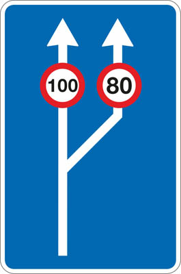
Indicates, on a section with a single lane of circulation, that it will transition to two lanes in the same direction of circulation. It also indicates the maximum speed permitted in each of them.
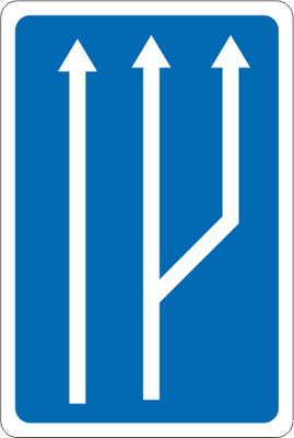
Indicates, on a section with two lanes in one direction of circulation, that it will transition to three lanes in the same direction of circulation.
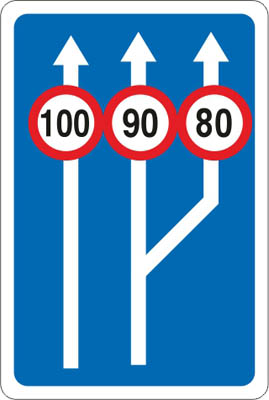
Indicates, on a section with two lanes in one direction of circulation, that it will transition to three lanes in the same direction of circulation. It also indicates the maximum speed permitted in each of them.
Indicates, on a carriageway with one lane, that a lane will merge from the right side.
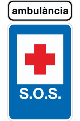
Indicates the location of an ambulance in permanent service for the treatment and transport of injured persons in traffic accidents.
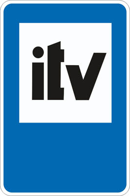
Indicates the location of a vehicle technical inspection station.
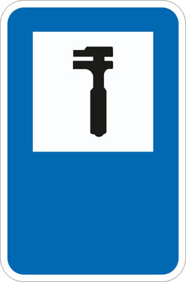
Indicates the location of a car repair workshop.
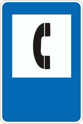
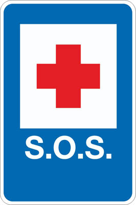
Indicates the location of a telephone device. If it includes the inscription “S.O.S”, it indicates the location of a telephone for permanent use to alert authorities of an accident or emergency on the road.
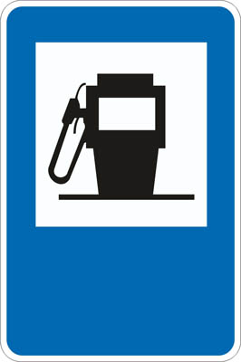
Indicates the location of a fuel dispenser or service station.
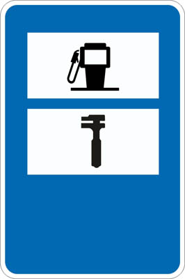
Indicates the location of a facility with a repair workshop and fuel pump.
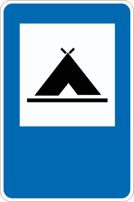
Indicates the location of a place where camping is permitted.
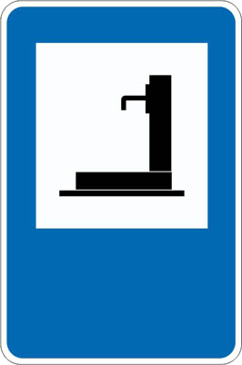
Indicates the location of a water fountain.
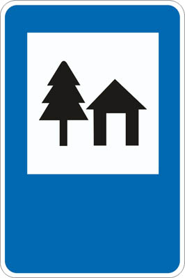
Indicates the location of a youth hostel.
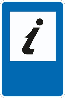
Indicates the location of a tourist information office.
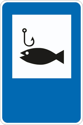
Indicates a lake or stretch of river where fishing is subject to special authorisation.
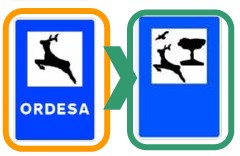
Indicates the location of a park or nature reserve.
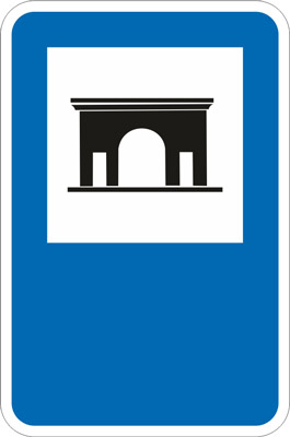
Indicates the location of land where camping with a caravan is permitted.
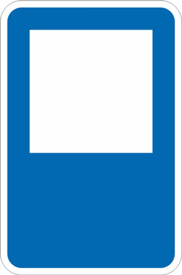
Generic sign for any other service, which will be inscribed in the white box.
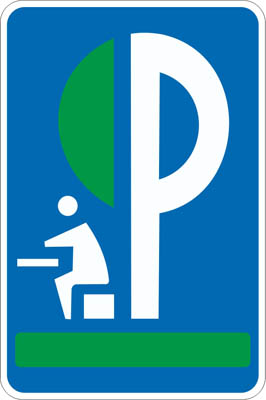
Indicates the location of a rest area.
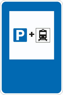
Indicates the location of a parking area connected to a railway station, primarily intended for vehicles of users who complete part of their journey by private vehicle and the other part by rail.
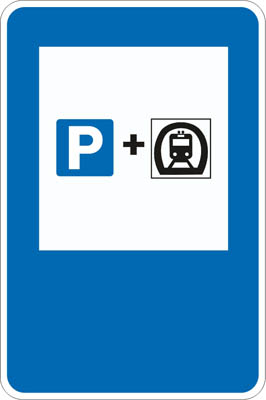
Indicates the location of a parking area, connected to a metro station, primarily intended for vehicles of users who complete part of their journey by private vehicle and the other part by metro.
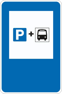
Indicates the location of a parking area, connected to a bus station or terminal, primarily intended for private vehicles of users who complete part of their journey by private vehicle and the other part by bus.
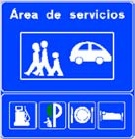
Indicates on a motorway or dual carriageway the location of a service area.
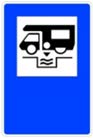
Indicates the location of a wastewater disposal point for caravans and motorhomes.
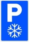
Indicates the location of an emergency parking area for snowfalls and, exceptionally, for incidents.
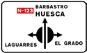
Indicates the directions of the various exits of an intersection whose layout is similar to a roundabout, but the main carriageway, on which the vehicle is travelling in this case, does not lose continuity. If any inscription appears on a blue background, it indicates that the exit leads to a motorway or a dual carriageway.
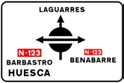
Indicates the directions of the various exits of an intersection whose layout is similar to a roundabout, but the main carriageway, on which the vehicle is not travelling in this case, does not lose continuity. If any inscription appears on a blue background, it indicates that the exit leads to a motorway or a dual carriageway.
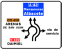
Indicates the directions of the various exits of the upcoming roundabout and the lane by which to access each of them.
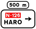
Indicates, on a conventional road or a multilane road, the destinations of the exits of the next junction when they lead towards a conventional road or a multilane road, as well as the distance to these exits.
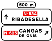
Indicates, on a conventional road or a multilane road, the own direction of the road being travelled and the destinations of the exits of the next junction when they lead towards a conventional road or a multilane road, as well as the distance to these exits.
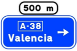
Indicates, on a conventional road or a multilane road, the destinations of the exits of the next junction when they lead towards a motorway or a dual carriageway, as well as the distance to these exits.
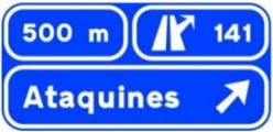
Indicates, on a motorway or a dual carriageway, the destinations of the exit of the next junction. It also indicates the distance to this exit, its number and, if applicable, the letter.
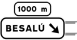
Indicates, on a conventional road or a multilane road, the destinations of the exit of the next junction when it leads towards a conventional road or a multilane road, as well as the distance to this exit.
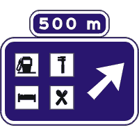
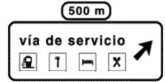
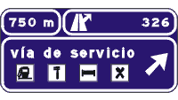
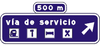
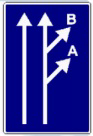
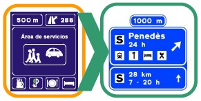
Indicates, on a motorway or a dual carriageway, the proximity of an exit to a service area, showing its name and opening hours in addition to the pictograms of the services it offers. The upper panel will show the distance to the exit. The lower panel will show the distance and opening hours of the next service area in the direction of travel.
Check that you know them
Road signs come up in every DGT exam. Take our free DGT theory test in English (30 questions with answers), or read about the new road signs introduced in 2025.